Custom Points Maps plugin allowed you
to display your location data in multiple interesting ways on top of map backgrounds like Google Maps,
Oracle Maps and Open Street Maps.
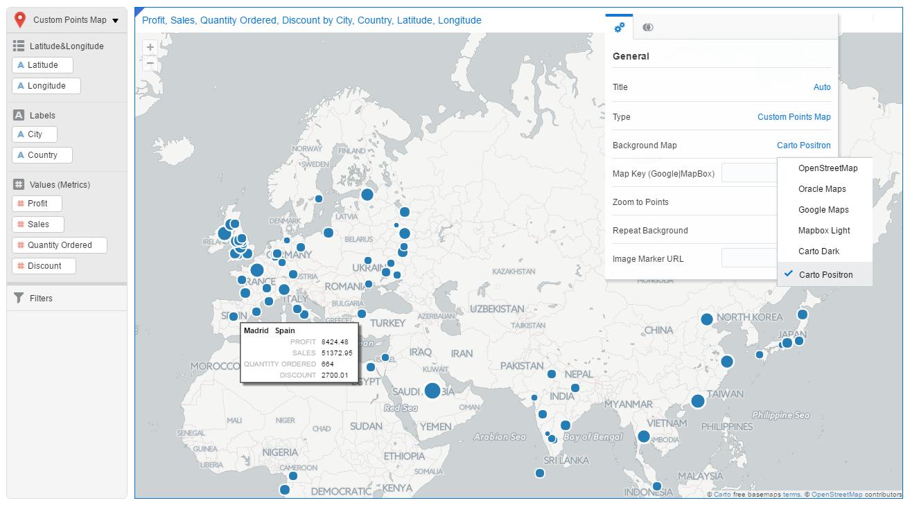
There are exciting new improvements to this plugin, for example with the new version more Background Map options are available. In addition to the existing Background Maps now you can use Mapbox Light, Carto Positron, Carto Dark background maps. It can now display attribute labels as well. Download it from Oracle BI Public Store.
Here is the list of all capabilities of the plugin. New capabilities added in this update are marked with *
- Choice of background mapsThere are exciting new improvements to this plugin, for example with the new version more Background Map options are available. In addition to the existing Background Maps now you can use Mapbox Light, Carto Positron, Carto Dark background maps. It can now display attribute labels as well. Download it from Oracle BI Public Store.
Here is the list of all capabilities of the plugin. New capabilities added in this update are marked with *
- Open Street Map
- Google Map (Road, Satellite, Shaded, Hybrid)
- Oracle Map
- *Carto Positron
- *Carto Dark
- *Mapbox (requires map access key)
- Image Markers
- Using local icons
- Using base64 encoded icon image
- Using a web URL
- Map Wrap Around or Repeat Background
- Auto zoom to displayed theme
- Feature Animation (Pulse)
- *Labels and Metrics support in Info window
- *Few other styling updates
Here is the video: ** Please note that this video is recorded using previous version of the plugin, so not all the new features described above are demonstrated in this video.
Are you an Oracle Analytics customer
or user?
We want to hear your story!
Please voice your experience and provide feedback
with a quick product review for Oracle Analytics Cloud!
2 comments:
I loaded this plugin, when I dragged my Lon and lat in, it showed image available, I changed in to google maps and a pop wind said that "this page can't load Google Maps correctly" and watermarked with "For Development Purposes Only". Any suggestion on how see my coordinates?
nice blog , very helpful and visit us for VISUALIZATION SERVICES in USA
Post a Comment